|
CUABENO LODGE
| MORE ECOTOURS
| MORE INFORMATION
The visitor center has a small botanical garden with flowers of the area like this orchid: Epidendrum jamiesonis., as well as bromeliads and Pampas Grass, Cortaderia jubata.
Visitors can enjoy the view from land or from an excursion boat at Laguna Cuicocha.
The Gorky Campusano trail around the lake is self-guided.
The Cuicocha offers an amazing view of the entire valley of Imbabura form
where San Pablo Lake, Otavalo, Altos de Mojanda and Atuntaqui can all be seen.
Mojanda
Lakes:
(about 3,500 masl): Caricocha, Huamicocha and Yanacocha.
They are located south of Otavalo.
Volcano yanaHurco of 4,538 masl: This is the best place to look for the
Andean Condors which are know to nest in this area.
Lodging: Along the highlands surrounding the reserve are small
accommodations like: Hosteria Los Pinos, Hosteria El Mirador and Hosteria
Tumbabiro.
There are also community inns linked to the UNORCAC-RUNA TUPARI project and
there is the Cuicocha Lodge, at the lake.
In the lowlands, is a cabin in Charco Vicente in the San Miguel District within
the reserve, while three community tourist operators in the buffer zone are:
Playa de Oro, KUMANII Lodge and San Miguel Lodge. Mountain biking: This is practiced along the Cuicocha - Antenas provincial road.
Los Cedros Biological Reserve at 1,400 masl: 60 km northwest of Quitoa and west of Cotacach.
Salto del Bravo: Small natural beach surrounded by tropical vegetation, located near the Agua Clara and Bravo Grande Rivers. To get there, it takes four hours from Bourbon to San Miguel by boat on the Cayapas River. Cascada de San miguel: 100 m waterfall, which be reached after an 8 hours hike from Charco Vicente. This waterall is close to the confluence of the Rivers Lachas and Santiago, at about four hours by boat from Bourbon, which can be reached along the Santiago River until the town of Playa de Oro.
Conservation status and facts of the Cotacachi-Cayapas Ecological ReserveThe Cotacachi-Cayapas Ecological Reserve was created on August 29, 1968 by
Executive Decree No. 1468, published in the Official Register of September 24,
1968 r.o. No 17.
Geology
The Reserve has an area of 243,638 ha
and its altitudinal range varies from: 30 - 4,939 masl.
The Andes flanks with extremely
steep slopes.
There are three volcanoes in the park:
the Yanahurco peak (4,538 masl), the Cotacachi volcano (4,939 masl) and the Lake
Cuicocha volcano. The Mount Yanahurco is a dead volcano which has been eroded by
Pliocene glaciers. The Cotacachi Volcano is a stratovolcano which was also
eroded during the Pleistocene, shaping it into a rocky pyramid. The temperature varies between 4 and 24 - C and annual precipitation between 1,000 - 5,000 mm depending on the elevation and exposure to the Andean winds.
The eastern part of the Reserve consists of very mountainous paramos with lots of rivers rocky streams, and in poorly drained areas, dozens of lakes and marshes of different sizes.
The natural vegetation is
grassland, with soils between sods covered by moss that retain a large
quantities of water in the poorly drained highland plains. Moreover,
cushion plants abound which also absorb lots of water. That is why
the reserve is considered a hydrological "sponge".
The Reserve has many waterfalls.
Only the Cotacachi - Cayapas Reserve covers only elevations from paramos to sea level in the Western Andes. This accounts for a great diversity and endinism, ranging from the paramos in the highlands surrounding the Cotacachi Volcano, to the moist premontane forests along the San Miguel. Important rivers that originate in the reserve and then drain to the Pacific Ocean are: Santiago-Cayapas, with the largest watershed in the Reserve, as well as the Esmeraldas and El Mira Rivers watersheds.
There are 24 micro-watershed in the Reserve, 8 of which have their total area within the reserve while the others have their largest areas outside the protected area. The Santiago-Cayapas River watershed comprises the sub-basins of the Santiago, Agua Clara, San Miguel and Cayapas rivers, of which the sub-basin of the Santiago river, located in the western part of the reserve, is the largest area within the watershed. The micro watersheds that drain the Mira River watershed originate in the upper and northern part of the reserve, while the microbasins supplying the Esmeraldas River watershed (Guayllabamba River subbasin) are located in the southern part of the reserve.
The caldera of the Cuicocha volcano has a diameter of 3 km, which lies at the foot of the Cotacachi Volcano. Its interior slopes are very steep. Within the crater, is a crater lake at a level of 3,068 masl and of 132 m deep, without superficial drainage. With an area of 657 ha it is the largest permanent freshwater lake of the Andean highlands of Ecuador. It came to be after a collapse of the caldera which was then filed with melting water and rainfall. Two little islands raise from the surface: Teodoro Wolf and Yerovi Islands, separated by the Canal of Dreams.
VegetationFloraWith the exception of the islets in Lake Cuicocha, where the native flora has been studied, no other botanic studies have been carried out in the park. Still, 2,017 species of vascular plants are known to the area and buffer zone, which represents 13.8% of the total number of Vascular Plants of Ecuador. The family with the greatest number of species is Orchidaceae with 201, followed by the family Melastomataceae with 149 and Araceae with 45.
The islets of Lake Cuicocha are characterized by having a tree stratum that reaches 15 m in height, where the dominant species are Columellia oblonga and Solanum sp. The tree trunks are covered with mosses, lichens and bromeliads. The vegetation of these islets may be the last remnant of this formation.
Of all the endemic vascular plants
growing in the country, 20% occur in the western part of the Reserve, which is
due to its location in the western flanks of the Andes mountains, combined with
being part of the a biogeographical region of Choco in Ecuador. The
Red Book of Endemic Plants of Ecuador reports 78 endemic species known to the
reserve and expects another 320 species to be present.
Evergreen lowland forest (0-300 masl): The canopies reach more than 30 m in height, predominating arboreal species of the families: Myristicaceae, Arecaceae, Moraceae, Fabaceae and Meliaceae, richly covered epiphytes and vines. The herb layer is dense, with lots of Araceae and ferns. Some characteristic species: Brosimum utile, Poulsenia armata, Rubber, Castilla elastica, Phytelephas aequatorialis, Wettinia quinaria, Astrocaryum standleyanum; Carapa guianensis, Guarea polymera, Otoba gordoniifolia, Nectandra guadaripo, Humiriastrum procerum, Theobroma gileri, Matisia alata, Cecropia garciae, and the endemic tree Swartzia littlei, Conostegia cuatrecasii, Tetrathylacium macrophyllum, Rhodospatha densinervia, and the herb Xanthosoma daguense.
Lowland evergreen forest (0 - 300 masl): Has a canopy of ore than 30 m high, with a predominance of tree species from the families: Myristicaceae, Arecaceae, Moraceae, Fabaceae and Meliaceae; covered by abundant epiphytes and vines. The lower stratum is densely populated with herbs, with species of the Araceae family standing out. There are also lots of ferns.
Evergreen Premontane Forest (300 - 1,300 masl): In the tree stratum is an abundance of palms, Mimosaceae, Fabaceae, Burseraceae and Meliaceae. The canopy reaches 30 m or higher, and the tree trunks are covered with orchids, bromeliads, ferns and Araceae. Herbaceous species of the families Marantaceae, Araceae, and ferns dominate the herb layer. Among the characteristic flora are these palms: Wettinia quinaria, Pholidostachys dactyloides, Iriartea deltoidea y Aiphanes erinacea. Other arboreous specis are: Virola dixonii, Otoba gordoniifolia; Protium amplum; Vitex flavens; Caryodaphnopsis theobromifolia. Some herbs: Irbachia alata; Begonia glabra; Monstera pinnatipartita.
Evergreen low montane forest (1,300-1,800 masl): This forest type covers only a narrow strip along the western flank of the Andes mountain range. The canopy is between 25 and 30 m high and most species and families representative of the lowland trees are absent, woody vines decline and certain families reach the upper limits of their growth. Epiphytes on the other hand increase in both species and abundance. Typical flora of this formation includes: Oreopanax confusus, Anthurium albispatha, Buddleja americana, Nectandra membranacea, Cladocolea archeri, Byrsonima putumayensis, Bellucia pentamera, Blakea punctulata; Siparuna laurifolia, Fuchsia macrostigma.
Evergreen montane forest (1,800-3,000 masl): Forest with the canopy between 20 and 25 m, trees, densely overgrown with mosses. IN this ecosystem epiphytes reach their greatest diversity both in number of species and abundance. About 95% of the trees in the hills of this cloud forest along the Santiago-Cayapas River are represented by two species: Carapa guianensis and Eschweilera sp., the former being the larger tree and possibly the only place where you can still find adults of this species is in the reserve. Typical flora of this formation includes: Anthurium mindense, Anthurium gualeanum; Gunnera pilosa, Bocconia integrifolia, Piper aduncum, Miconia crocea, Cedrela montana, Chusquea scandens, Puya glomerifera, Centropogon calycinus, Meriania maxima, Cinnamomum palaciosii, C. triplinerve; Freziera canescens.
Evergreen altimontane forest (3,000 - 3,400 masl): Forest floor densely covered with moss and irregular growth of trees with trunks branching out from the base, hanging over, and sometimes almost horizontal. In this formation the following species can be found: Cotula australis, Critoniopsis palaciosii; Tournefortia fuliginosa, Valleys stipularis, Gunnera pilosa, Nasa grandiflora, Brachyotum ledifolium, Siparuna echinata, Aa maderoi, Passiflora pinnatistipula.
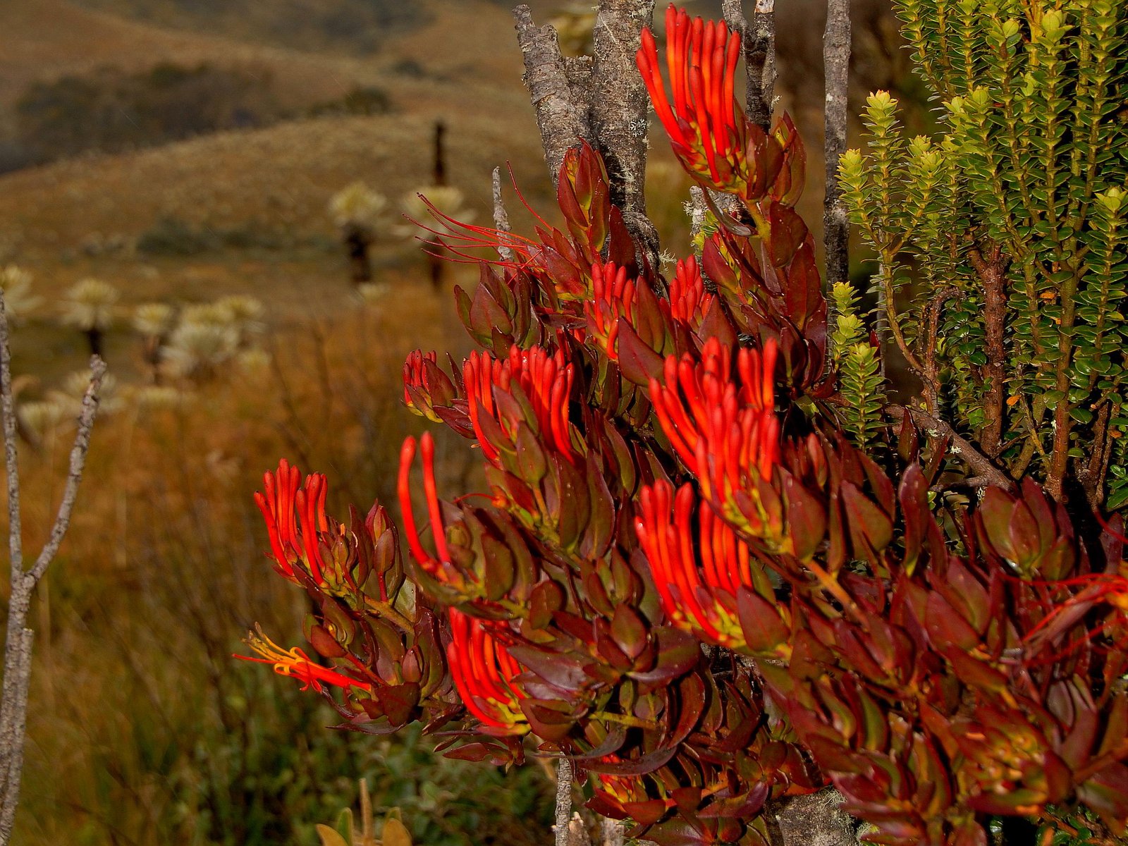
The Hercules Club, Puya-clava herculis, is a fascinating bromeliad in the paramo that grows up to 4 m.
Herbaceous Paramo (3,400 - 4,000 masl): It is dominated by graminoids of the genera Calamagrostis and Festuca, intermingled with other types of grasses and small shrubs. The species Calamagrostis effusa is restricted to the paramos of the provinces of Carchi and Imbabura. Characteristic flora: Chuquirahua, Chuquiraga jussieui, Oritrophium peruvianum; Huperzia talpiphila, Nototriche phyllanthos, Peperomia fruticetorum, Castilleja sp. and Valeriana sp.
Gelidofitia (4,000 - 4,700 masl): Formation dominated by dispersed shrubs and xerophytic plants, lichens and mosses. The rhizomes and roots are strongly developed and the leaves are small, often protected by hair. Characteristic species : Draba aretioides, Loricaria ferruginea; Valerian pilosa and species of mosses, Andreana sp. and Grimmia sp. and lichens, Lecanora sp. And Gyrophora sp.
MammalsOf the 139 known mammals of the reserve bats and rodents are the most common.
Among the larger mammals living in tjhe area: Tigrillo, Leopardus pardalis, Leopardus wiedii, Yaguarundi, Puma yagouaroundi, Andean Cat, Oncifelis colocolo, Puma, Puma concolor, Jaguar, Panthera onca, Bush Dog, Speothos venaticus, Coastal Otter, Lontra longicaudis, Coastal Howler Monkey, Alouatta palliata and Ecuadorian Capuchin Monkey, Cebus albifronsae quatorialis.
13 species are considered endemic for
the Choco region, among them a new species of Spiny Mouse,
Heteromys australis, and 20 species are threatened: Hippocamelus
antisensis; The Giant Anteater, Myrmecophaga tridactyla, and the
Woolly Tapir, Tapirus bairdii, probably already disappeared in the area,
while the Pacarana, Dinomys branickii, is probably rare.
birdsThe greatest bird diversity is estimated at 500 to 700 species, where is lies below 600 masl, although at this elevation of the area covered by the reserve is probably insufficient to protect viable populations of some of the threatened species of the lowlands of the region, such as: Harpy Eagle, Harpia harpyja, Great Crax, Crax rubra, Military Macaw, Ara ambigua, Five-Colored Bearded, Quinticolored Capito, Tin-breasted Dacnis, Berlepschi Dacnis, and Blue-Biggled Tangara (Tangara johannae). The Reserve possibly includes: Yellow Orejia Parrot, Ognorhynchus icterotis, Grey Falcon, Micrastur plumbeus, Fringed Ant Cuckoo, Neomorphus radiolosus, and Umbrella Bird, Cephalopterus penduliger.
In Lake Cuicocha the Silver Dipper, Podiceps occipitalis juninensis, and Andean Teal, Fulica ardesiaca are breeding.
The number of bird species belonging to
the lowlands under 600 m in reserve is estimated to be between 500 and 700
species. The area at this eleavtion covered by the Reserve is probably not
enough to maintain viable populations of some endangered lowland species such
as: Harpy eagle, Harpia harpyja, Crax rubra, Greater Green Macaw,
Ara ambiguous, Capito quinticolor, Dacnis berlepschi, and
Tangara johannae.
Other CrittersHerpetofaunaThe herpetofauna of the reserve consists of 235 species, of which 124 are amphibians y 111 are reptiles.
AmphibiansThe greatest amphibian diversity is found in the montane forests, while the reptiles are concentrated in the lowland. The conservation status of reptiles is not known, while the number of threatened amphibian species is as high as 40%, including: Centrolene ilex, Atelopus elegans, A. coynei, A. longirostris , A. mindoensis, Rhaebo blombergi, R. caeruleos tictus; Hemiphractus fasciatus, Hyloxalus awa, H. chocoensis, H. toachi; Euphorbiaceae, Echinacea, Echinacea, Echinacea, Echinacea, Echinacea, Echinacea, Echinacea, Echinacea, Echinacea, Echinacea, Echinacea; Gastrotheca plumbea, Bolitoglossa chica, Caecilia leucocephala and Caecilia pachynema.
ReptilesAmong the 100 y 150 species, the lizard Ameiva septemlineata is the most common species. Also common are: the Chonta snake, Clelia clelia, the South American Snapping Turtle, Chelydra acutirostris, the White-lipped Mud Turtle, Kinosternon leucostomum postinguinale, Basiliscos sp., Enyalioides heterolepis, the Boa, Boa constrictor imperator, False Coral snake, Oxyrhopus petola sebae, Coral snake, Micrurus dumerilii transandinus, Trachyboa boulengeri, Mexican Pit viper, Bothrops asper, Lachesis acrochorda, Porthidium nasutum, en the endemic snake Atractusdunni.
FishesThe ichthyofauna of the area is made up of 33 resident species, of which 7 are eaten by the local population.
Getting there
Lake Cuicocha:
From the Panamerican Highway, drive to
Cotacache, and from there take the road to the lake about 12 km southwest of
Cotacachi.
Best toursWhat we do now:
Dear visitor, our website gives you info about our National Parks Tours, our Galapagos programs, the Cuyabeno Loop, as well as our Cuyabeno and Cofan Lodges in the Amazon. For those who want to combine the Exuberant Nature of Ecuador with the Famous culture of Peru, we even have a 7 days Highlights of Peru extension! Our website gives you the best information on the internet, like Ecuador Travel Guide, because we are the only tour operator run by professional biologists. Take a look: LAGUNA CUICOCHA IN COTACACHI CAYAPAS ECOLOGICAL RESERVE
PARKS & TRIBES Travel Agency in Quito Ecuador Address: Las Casas, Crossing Street: Jose Coudrin, 2 streets above the Occidental Highway, Canton Quito, Prov. Pichincha, Neighborhood Belisario Quevedo Whatapp: Telephone: +593 2 2 50 5310 Mobil: +593 96 29 35 271 NO SEXI-VIDEOS, BUT SOLID INFORMATION FROM REAL EXPERTS |


 +1 304 901 0718